
Last year we explored the Capital (mountain bike) Trail where it crossed the Lammermuirs. This year, I fancied checking it out further, and there looked to be a suitable section running from Yair (near Selkirk) eastwards to Traquair. With a sunny day forecast, Colette and I decided to try it out, and we were joined by our friend Keith, a keen mountain biker who was eager to explore it too.
Starting off from Innerleithen, we first rode to Yair via the single-track road that follows the River Tweed westwards and forms part of National Cycle Route 1. That was a fairly quick ride, even though Keith and I were on our mountain bikes and Colette was on her hybrid.
After about 10 miles, NCR 1 diverges, with a rough track option peeling off to the right. As it was an off-road type of day, we went right. That took us through a country estate on a bumpy road. The road wasn’t at all tricky, but Keith and I managed to get tangled up and both fell off, thankfully at low speed. Not a great start, but it wasn’t enough to put us off.
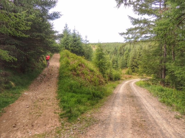
We got back onto tarmac and were looking for the point where the Capital Trail turns right away from the road and heads up into the hills. We didn’t see anything marked, and all we could find was a gate into a field of long grass, which didn’t look very promising. The other possibility was to use a forest track that started nearby, with the aim of intersecting the Capital Trail further up. We took the latter option and headed up a not too steep and quite well surfaced forestry road.
After a while, we stopped for a rest and a drink, which was when Colette discovered that one of her water bottles had jiggled loose and was lost. That was a bit of a worry, as it was going to be a long day of climbing in the sun, so we would need all the water we could get.
This is where it started to get serious!
Further along, we came to a left turn running steeply uphill. I stopped just in case this was our turn, and yes it was, so I went back a bit for a run-up and set off in low gear. Keith went on ahead and kept pedalling all the way to the top, whereas I stopped after a while and pushed. Keith wasn’t actually going all that much faster to be honest, and I thought it wise not to burn myself out so near the start.
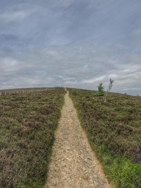
Yes, it really was that steep!
The three of us came together again at the top of the climb, where we met up with the Capital Trail and also the Southern Upland Way, which both followed the same path for most of the rest of the ride. After a quick break, we set off up the steep and rocky walking track, partly cycling, partly pushing. With some effort, we made it to the top of the Three Brethren hill, which takes its name from the three large cairns that stand alongside the white-painted trig point. This was where we planned to have our packed lunch, and at about 1pm, the time and place were both right.
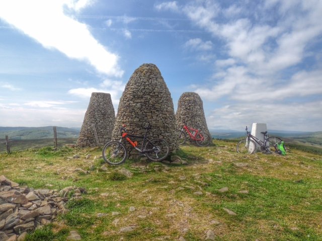
The Three Brethren
The view from the Three Brethren was amazing, with a 360 degree panorama. It felt that we must be at the highest point and that from here it was surely downhill all the way. I don’t know how many times I’ve thought that, only to be disappointed, but I was still feeling optimistic at that point!
The downhill run straight after lunch was quite rocky, but with fat tyres and shock absorbers on my front forks, I was able to build up a decent head of speed as I followed Keith down the track. However Colette’s bike wasn’t built for that kind of punishment, and she had to pick her way down much more slowly and carefully.
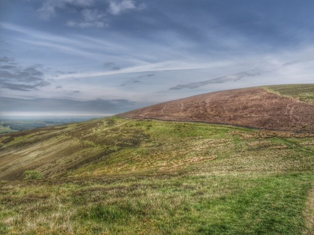
This was my favourite part of the ride
Over the next mile or two there were more fun downhill sections, well fun for me and Keith anyway, including a lovely smooth one over short grass. The downhill had to end though, and it did so at a gate, where we met two cyclists coming the other way, just finishing their descent of the next big hill for us to climb. We chatted for a little while, but then had to face the fierce-looking gradient.
It was very hard to push the bikes up such a steep slope on loose gravel, but once we got round the corner the gradient eased. On the other hand, we could now see the climb stretching off into the far distance. This took us up to near the top of Brown Knowe, and at about 1700 ft, we were now significantly higher than we had been at our lunch stop. By the time we reached the top, Colette and I were feeling tired, but Keith still had a spring in his step and shot off down the path on the other side.
After some descending, we came to a fork in the road, with the Minchmoor Road heading down to Yarrowford. We found a couple of guys there, waiting for their Duke of Edinburgh Award charges (a group of four girls) to come into view. We were able to tell them that the girls weren’t far behind. Like us, they were lucky to have such a good day for their expedition.
We carried on westwards, now climbing again, as we passed Minch Moor hill to reach the highest point of our journey. After that, due to the water bottles running low, we abandoned the Capital Trail in favour of the most direct route back, and it really was downhill all the way from there. Normally that’s a good thing, but it was very steep and rocky in places. Add to that the fact that Colette was now very tired and dehydrated and riding a bike that wasn’t ideal for the terrain, and it became quite a slow descent.
It was such a relief to reach tarmac at Traquair, just a short ride away from the car at Innerleithen. We had to stop at the shops for emergency rehydration (and ice cream!), after which we felt so much better. It had been a really tough ride, especially for Colette, but well worth the effort. Now to research a proper mountain bike for Colette…